
The Massif des Bauges, natural regional park since 1995, covers between 250 and 2217m and an area of 856 km². The park is divided in the two departments Savoy (46 municipalities) and the Haute-Savoie (18 municipalities). The 64 municipalities in the Park hosts 70 000 inhabitants (in 2008) and are part of the department Rhône-Alpes. There are six towns, which are also members of the Parks joint union, and in total 400 000 people are living in the park.
A wide variety of natural habitats
Forest covers 58% of the parks territory and provides the resource wood which is very important for the local economy. Grasslands, which are represented in 30 % in the parks area, are split in hayfields and pastures.
A more detailed analysis of the habitats shows a wide variety, which includes dry grassland in the south-west, wetlands in the lower valleys and rock and scree habitats in the highlands. An exemplar of this diversity is maintained through the Parks’ NATURA 2000 network (7 areas cover 17 000 ha).
Thanks to the landscape diversity, there is also a rich flora diversity to find in the park. 1600 species were identified in the Parks territory, which means a 1/5 of the French flora. Some of them are strictly protected like the lady’s-slipper orchid (Cypripedium calceolus) and the Alpine Sea Holly (Eryngium alpinu). Next to the flora, the fauna is also very varied. The Park observed 117 species nesting in the territory, including many endangered species: golden eagle (Aquila chrysaetos), Peregrine Falcon (Falco peregrinus) and the Black Grouse (Tetrao tetrix). A study of the National Office for Hunting and Wildlife (ONCFS) found out that the chamois is the most symbolic large mammals of the park. In the core area of the natural regional park, the reserve of national hunting and wildlife of the Bauges, the chamois, mountain sheep, grouse and many other animals are protected in a territory of 5200 ha forest and alpine meadows. Since 2003 the park is managing this part of the region in collaboration with the National Forest and National Office for Hunting and Wildlife.
The missions of the Park
For a better way to accommodate the public and the same moment to preserve and reveal the heritage and landscapes while contributing to a sustainable development of this exceptional area, which is surrounded by six cities, the Park developed a charter. The charta includes the following main axes and the working program:
- sustainable urban planning – the park ensures the compatibility of urban planning documents with the plan of the park
- support of local economy activities with especially local products (agriculture and forest in particular)
- the knowledge, protection and management of the natural and cultural heritage
- support of all forms of sustainable tourism, which are developed in respect of the resources
- environmental education: the park is an active member of the Reema and the Alparc working group « environmental alpin education », which means concretly having exchanges on an international level. The park has also participated at the ViViAlp project , an educative tool (a 3dimensional flight over the Alpine protected areas on a big screen) for understanding, discovering and learning something about the Alps.
- An experimentation like the agri-environmental measure to accountability for results "prairie flowers " (it is the Regional Park Bauges, who, inspired by Swiss and German initiatives, has initiated this program in France, now extended to the entire country.)
GEOPARK, a label given by the UNESCO
In September 2011, the natural regional park Massif des Bauges got the label Geopark . The global network of Geoparks aims to promote the Earth heritage, especially the geological one, to the public, and to support the local sustainable development of territories in form of geotourism. Nowadays there are 50 Geoparks in Europe – 4 of them in France.
On international level the park develops partnerships with the Luberon Geopark (France) and the Geopark d’Arouca (Portugal) concerning a sustainable resource tourism , which is financed by the European LEADER program. Another convention was signed with the Geopark de Leye Fengshan (as well for tourism projects) and the Altai Mountains in Russia.
Park's identity card
|
Name of protected area |
Natural regional Park Massif des Bauges |
|
Managing enterprise |
Joint Union of the Natural regional park |
|
Country |
France |
|
Area (ha) |
85600 |
|
Year of creation |
1995 |
|
UICN category |
V |
|
Legal basis |
Natural regional park |
|
Included regions |
Rhône Alpes |
|
Number of municipalities |
64 |
|
Highest point (m) |
275 |
|
Lowest point (m) |
2217 |
|
Population |
70 355 habitants (in 2008) |
|
Population |
58% |
|
Glacier surface |
0% |
|
Pasture surface |
6500 ha pastures for 120 pastoral units |
|
Prevailing landscape types |
forests, grassland, rivers, pastures, rock walls |
|
Emblematic fauna |
chamois (Rupicapra rupicapra), mouflon, Golden Eagle (Aquila chrysaetos), Peregrine Falcon (Falco peregrinus), Tétras lyre (Tetrao tetrix), Hazel Hen (Tetrastes bonasia), 150 bird species, 9 amphibien species |
|
Emblematic flora |
Potentilla delphinensis, Carduus nutans subsp. Alpicola, Cypripedium calceolus, … 1600 plant species |
|
Major touristic attractions |
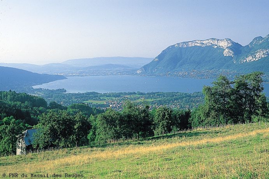
National reserves of hunting and wildlife (5000ha), lake of Annecy and nature reserve Bout du Lac, stream Chéran, ravine Pont de l'Abîme, look-out Revard, Arclusaz, villages as La Compôte |
|
nformation center(s) |
3 informationscentres of the park (Main house of the park, House of fauna and flora, house of heritage) where you can find further eco museums |
|
Internet site |
|
|
Number of employees |
32 employée |
|
Access |
by train: from Paris or Lyon, you can take the TGV to Chambéry, Aix les Bains or Annecy, the train station Montmelian or Albertville; by car: from Lyon take highway A 43, from Geneva and Annecy highway A 41, from Grenoble highway A 41 |


